Author Archives: Lisa Hirschfield

Necropolis update

Different facets of this project have been moving at different paces throughout the semester (by “facets,” I do not mean “people”).  At this point  every day seems precious, and at times it’s felt to me like we’ve/I’ve been running in place. Actually, seems more like we’ve been running in widening concentric circles, or a fibonacci spiral (which is coincidentally the logo of Omeka, the platform we’ll be using). Accordingly, each time we come back around, we are really in a slightly different place: we know more and have better understanding of where we were before.

Taylor, who is handling most of the development, and I discussed the project at length today. The complicated dual function of this project– to create both a tool for converting a database into a JSON script, and a demonstration of what this tool might help visualize about a historical cemetery– is finally resolving itself into a clear and finite set of tasks to be completed: the website, the historical documentation, and the datatbase component. Each of these is challenging in its own way, but there is consistent movement on all fronts.

Necropolis project update

On Sunday, the four of us met in the history department and reviewed where we are now with the project and what we have left to do.  Taylor showed us the model spreadsheet he is creating that will be transformed into a Json script so we can use it to visualize data. I presented the maps I’d found and we decided on what would be best to use for layering. We want to depict three historical periods corresponding to the three cemeteries belonging to Congregation Shearith Israel. Although we’re focusing on the second cemetery, using this framework will allow us to depict the growth and development of the city, which is a large part of the story we’re telling with this project.

We also talked about how we would design the site in terms of what we can and/or should visualize to demonstrate how this model works, the structure of the site interface, and what type of historical information we’ll include in a “mini-essay” section. Conn, Davide, and I have divided up this historiographical task,  and Taylor is creating a logo for the platform. We are meeting again this Tuesday evening (April 26). Finding time to work together outside of class, even if we’re doing individual tasks, has been extremely helpful. (For one thing, we are not in a small, hot, crowded room.) But more important, I think face-to-face interaction makes it easier to bounce ideas off of each other, helps to develop a mutual vision for the project, and sharpens our focus. This is true, at least, for the project manager (me).  As the project manager, I can also say that meeting outside of class also reaffirms to me that everyone on our team has been absolutely indispensable to this project – not just because they know what they’re doing and they work hard at it, but because they have each contributed ideas, knowledge, and a personal sensibility that have been vital to the project’s development.

Necropolis Group Update

As time is becoming a concern, we more or less decided that for the next couple of weeks we should each focus and be responsible for one thing instead of working on overlapping tasks. (Well, I decided this, but this M.O. seems to have been the general trend.) Overlapping tasks was useful earlier on, because it helped all of us get a better sense of what the scope of this project is. But now we have to buckle down. Taylor is going to work on the platform, while Conn, Davide, and I put together the rest of the content. This entails gathering historical background, because this project also involves narrative description in short and long form, and we need material for that. Davide is working on this portion. I working on obtaining digital maps and georectifying them to correspond with Open Street Map. Conn is working on getting the database of physical conditions (cemetery monuments, etc.) in place, since we have to recreate it from records rather than the electronic database we were hoping to access.

Despite that setback, on Thursday I had a great talk with Rachel Frankel, an architect and historian of Jewish cemeteries, who is working with the congregation on restoring the 11th St. site, and who has had long-term Jewish cemetery restoration projects in Suriname and now Jamaica. She pointed the way to some additional sources of information, and had good suggestions for how we might reconcile some data discrepancies in terms of people recorded as buried in two different places at the same time. (Some people were in fact moved much later after burial, but this is carefully documented.) The records aren’t necessarily sloppy, but they may actually reflect the political jockeying within the congregation for burial in preferred locations. This adds a whole new dimension to the social life in and around the cemetery that we are mapping. Rachel also provided us with the identity of one of the weirdest burials in the cemetery: a flat tomb cover that is cut off at the top, at an approx. 65º angle where the fence was built. It’s odd because all the monuments had to be lifted and re-situated when the site was raised to meet the grade of the street; you’d think the stone would have been moved sufficiently inside the grounds, rather than “decapitated” when the cemetery’s front wall was put up shortly thereafter. Usually the term “history’s mysteries” would suffice for something like this, but in the case of the 11th St. cemetery, “history’s inconsistencies” is probably more accurate.

Necropolis group update

This weekend, despite Conn’s friendly but urgent request, we did not have an opportunity to go through the archival material the synagogue was going to provide us. It’s likely that these documents are still in a Newark storage facility. Hopefully they will be brought back soon.

We are also waiting to get the conservator’s data on the site, but they must either have permission from the synagogue or, more likely, will only provide it to the sexton, who can then give it to us.  We will continue to send reminders on both of these things, but in the mean time there is a lot of other work to be done. All of these records will provide very helpful and (we hope) fascinating information, but it isn’t necessary to wait for them.

Our immediate need is to build a solid, clean database of names, dates, locations, and personal information, and this naturally has to begin with ensuring we have as many names we can verify.

At the New York Historical Society on Saturday Conn and I went through city directories for years spanning from 1786-1830. In addition to providing some of the information we need, this process also revealed how much the city changed in this period of time. The size of the directories expanded, and the number of Jewish names also increased substantially. As families grew, there were many more of the same names too. (This is true for everyone in the directory, of course.) They were increasingly fewer Sephardic names as well, which makes sense, since Ashkenazi Jews were beginning to arrive in greater numbers.

Once the database is put in shape, we can move on to searching death records in FamilySearch database. Since I have a (free) account, this won’t be difficult. An initial foray into these records provided a great deal of information – perhaps more than we can probably get from our archival sources: names, birth and death dates, birth location, death location, spouse/status, occupation, and cemetery. In this last piece of data, that usually reads “Hebrews.” This is extremely helpful: I came across a couple of people who died during our target time frame with the same or similar names as those on our list, only they were buried in Trinity or another Christian cemetery — or Potter’s field. Definitely not the same people!  It’s very unlikely that any Jews would have gone to Potter’s field because the congregation generally took responsibility for burying people who were indigent, whether or not they were active members. According to the sexton, it still does this on occasion.

In the later stages of the database construction (which is soon), we will begin doing more background reading to help us with the narrative components of the site. Most of these secondary sources include information about the congregation and  especially prominent individuals in the congregation, a number of whom on our list.

I got in touch with Rachel Frankel, who did the initial transcription of the burial ledger we saw. (At this point, we’ve seen more documents than she did last summer when she worked with the conservators.)  She’s interested in our project and will be giving us the transcriptions she made of still-legible headstones in the cemetery.

We are also rethinking our initial direction in terms of the platform and tools we’ll use for the website. Now that hosting is an option, this creates many more possibilities for the kind of visualization and content we can feature.  Although we’re still quite a way off, it’s exciting to imagine what we might be able to include.
Necropolis- group update

Friday morning Conn, Davide, and I spent time in a basement room of Shearith Israel’s amazing synagogue on 70th Street and Central Park West. Our tasks were to verfiy the information we had from several secondary sources and to determine which volumes from the synagogue’s offsite archives should be retrieved for further investigation. All this thanks to Conn’s diligence (and temporarily flexible schedule)!

Thankfully Conn was able to devote a significant part of the day to this work, and when he was finished he had a list of 95 members of the congregation who died between 1805 and 1830, the period the 11th Street cemetery was active. Once the archive volumes arrive, we will be able to dig deeper, as it were, to learn (we hope) who was definitely buried there, where they lived, when they were born, and other information we can glean about their lives.

Before Davide and I left, the sexton Zach Edinger gave us a tour of the synagogue’s two amazing sanctuaries, and some of its “relics” (including two millstones that are among the oldest colonial-era objects in the city). The current building dates from 1897, but most of the furnishings in the “little sanctuary” were taken from the original 18th century synagogue on (then) Mill Street.  The main space is not so little: it includes what looked to be a 60-foot ceiling, with three walls of Tiffany windows that are themselves about 25 feet tall.  Zach invited us up to the ark, where the Torahs are stored, and took one out and unwrapped it so we could examine it closely. I asked him how old their oldest Torah is. The answer: very old! It was a gift from the synagogue in Amsterdam to the first congregants in the 17th century, and was then considered to be an antique. So it’s at least 500 years old, but possibly dates from pre-expulsion Spain (i.e., before1492).

It was interesting to note the numerous resemblances – both physical and ritual – to Catholic churches. Zach pointed out that until they left Spain – and later, Portugal – most of the Jewish refugees in Amsterdam and Brazil had been forced Catholic converts, also known as “crypto-Jews.”

Taylor is jumping into the tech side of things with apparent gusto, which I am grateful for. When we started, we had all more or less expressed interest in learning more DH technologies and being involved with the design, rather than keeping to discrete roles that wouldn’t leave much room or time for learning or doing new things. I’m hoping we can build in a little overlap once things are set up, so that everyone gets to experience  something besides the main thing each of us are doing.

Necropolis group update

Field Trip

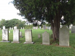
Today our project team met onsite with Zach Erdinger—the sexton of Shearith Israel—and one of his associates. He graciously answered questions about the historical information he had provided us (a large set of documents and reports) and gave us a tour of both the 11th St. and 21st St. cemeteries, relating stories about some of the more well-known occupants, offering additional background information, and updating us on both cemeteries’ restoration.  He has already made connections for us to a team of conservators who surveyed the 11th Street site last summer, and we will be contacting them shortly.

We also learned that many records and old documents are archived in Newark, NJ and that he will make these available to us for further research. At one time a database existed, which had also possibly served as the back-end of a simple online interactive map. Unfortunately, the website is no longer active and it seems that neither the creators nor the host backed up the information. Nevertheless, this points to the likely existence of more detailed records about cemetery occupants and memorials. It also serves as an important object lesson in backing up data!

Unless the original database records are found, our next step will be to reconstruct the database, beginning with a basic table of information we currently have in hand: names, some vital statistics, and some biographical information. We will also be looking for these individuals in the late 18th- and early 19th-century city directories and property maps held by the New York Historical Society, to determine any home and/or business addresses. Finally, we will connect, where possible, family and individual names with those in three published collections of primary source documents, to supplement the biographical data we have.

Necropolis update – Lisa Hirschfield

This week I spent a great deal of time obsessively working on the website I set up for our project, https://necropolis.commons.gc.cuny.edu/. Of course, it still has a way to go – such as an empty project description page – but the first post is up and I’m encouraging everyone to post about things they find and their activities as they relate to the project – a slightly more formalized version of what we do for this site,  geared specifically toward the public. To that end, Taylor set up a Twitter account for Necropolis, @BNecropolis, to boost publicity.

Every time I describe this project I see more clearly how, while we may not create new tools from scratch, we will be configuring existing tools in new ways that have great potential. I am continually surprised by how many historic cemetery websites have clunky, 1990s-era technology driving their public interface. Or, they have beautiful, fancy platforms that clearly cost a bundle, but are nevertheless limited in what information they can visualize. We want Necropolis not only to function as a set of physical maps, but also as a set of conceptual maps.  We want it to be relevant not only to visitors, but also to scholars and students in remote locations.  If, eventually, we can take whatever configuration of software we develop and bundle it into a single, elegant installation for organizations to make use of for their own historic site projects, then my purpose on this planet will be fulfilled. It may not happen this semester, though.


Necropolis group post – Laying the foundation

We were really feeling the pressure to find a partner site and on Tuesday I announced in class that I’d just spoken with the Zachary Erdinger, sexton of Shearith Israel, who is extremely interested in our project.  We both agreed that the small size of the second (11th St.) cemetery, its occupants, and its history, as well as the physical restoration underway, make it very suitable for a one-semester project.

Since then, the Mr. Erdinger sent us a large trove of materials relating to the second cemetery that the synagogue has collected in the past few years in the course of its restoration efforts. Most of these documents are from the early 20th C, but a few date back to the very late 18th C, and include everything from architectural renderings to documents pertaining to the reinterment of remains prior to street expansion.  The archive also includes portions of and references to some excellent secondary sources, which document the early history of the congregation and the cemeteries. Fortunately most of these are accessible through the Lehman College library, NYPL, and Columbia.  The reading material is piling up!

In the mean time, group tasks are on target: Davide has begun to catalogue the materials we were given (which I will also help with), and he found a beautiful 1830 street and property map via NYPL Labs that I am hoping we can adapt as a base map (with proper attribution). Tyler set up a GitHub repository for the project and a project Twitter account: @BNecropolis. I set up a public website on the CUNY Commons, Building Necropolis, that will document the development of Necropolis, and which we can share with Shearith Israel.  I’ve been trying to tweak social media options on the site so that posts will automatically go out on the project’s Twitter feed, but the CUNY Commons configuration may make this difficult. However, the project is now “following” a number of organizations and individuals on Twitter whom we hope will help us spread the word. The site isn’t complete yet, but the first post is up, as well as the project team page.  A more in-depth project description needs to be added on a separate “About” page.

We are in communication with Mr. Erdinger to arrange a site visit later in the month. Conn is working up a data collection form for our physical survey of the site and, at some point, of its sister cemeteries on  St. James Pl. (Chatham Sq.) and 21st St.


Necropolis: mapping historical cemeteries

This is a complex project with the potential to go in several different directions.  At this point, we are still in the process of defining project goals, given these choices. To a large extent, what we do will depend on the site we choose (but establishing that partnership will depend on what we describe doing) so it’s a bit of a catch-22.

We expect to make contact with the congregations/organizations that manage the prospective sites this coming week. In the mean time, our team has been communicating on Basecamp about what we’d like to achieve, and providing reference material to each other, to better articulate what we imagine creating.  Everyone has been extremely thoughtful and detailed in their responses to my initial questions about how they see the project in relation to the original proposal. I’ve set a deadline, with tasks, for identifying and establishing a site partnership with a local cemetery: March 6. Between then and now, I think we will need to discuss in more detail our personal wishes for this project, and see where they overlap, in order to develop a clear goal we can all begin working toward. (Understanding, of course, that the project will probably end up looking different from even the hybridized version.)

At this point, I am acting as the PM, Conn is doing outreach, and Davide and Taylor are beginning to develop a theoretical structure that goes beyond “purpose.”  (Conn and I are throwing in our two cents on this as well.) For the time being  we will keep to this arrangement, and revisit it once we are deeper into the project’s development.IMG_0120

GIS workshop

A few weeks ago I was fortunate to be able to attend an all-day GIS workshop offered by Frank Connolly, the Geospatial Data Librarian at Baruch College. It was very thorough and by the end everyone had finished a simple chloropleth map. For those of you interested in continuing with map-related DH and can spare a friday, I recommend the workshop, which is free and offered several times a semester.

Most professional GIS projects use ArcGIS, made by ESRI, and many institutions subscribe to it to support their GIS projects. It’s not cheap. But, (yay!) there is an open-source alternative called QGIS, which anyone can download. This is the software we used in the workshop. QGIS is far more versatile than CartoDB, but it also has a complex interface and a steep learning curve.

In the workshop, we covered the pros and cons of various map projections (similar to some of our readings) and different types of map shapefiles (background map images); GPS coordinates vs. standard latitude/longitude (sometimes they differ) ;how to geo-rectify old maps so that they line up with modern maps and geocoordinates; open data sources; and how to organize and add information to a QGIS datababse.

The entire workshop tutorial, which participants took home, is available on the Baruch library website. If you’re comfortable learning complicated software on your own, it’s a great resource. Personally, I would need to spend a lot more time working with QGIS, with someone looking over my shoulder, to get a feel for the program. But practicing with the manual over the winter break will be on my ever-growing “to-do” list.